Wheat Ridge, Colorado Community & Real Estate Guide
A local guide to Wheat Ridge real estate, established neighborhoods, Clear Creek, parks, redevelopment, transportation, and what buyers and sellers should consider.
Search Wheat Ridge Homes for SalePreston's Perspective
Wheat Ridge is a market where two homes a few blocks apart can have very different real estate characteristics. Much of the city's housing is established, but lot sizes, renovation levels, zoning, street patterns and surrounding development can vary significantly. At the same time, newer housing and redevelopment around major corridors, the Ward station area, Clear Creek Crossing and the former Lutheran hospital campus are adding another layer to the market. For buyers, I would pay close attention to the individual property, its lot, condition, zoning and immediate surroundings rather than relying on a broad Wheat Ridge average. For sellers, the best comparable homes are usually the properties that compete for the same buyer based on location, housing type, condition, lot characteristics and access.
Key Takeaways
- Wheat Ridge has a substantial stock of established housing, with much of its single-family inventory dating from the mid-20th century.
- Lot size, housing condition, zoning and neighborhood character can vary considerably even across relatively short distances.
- Newer housing and redevelopment around major corridors, Ward station, Clear Creek Crossing and the Lutheran Legacy Campus are creating additional property and location considerations.
Wheat Ridge at a Glance
- County
- Jefferson County
- Location
- Immediately west of Denver
- Community Type
- Established inner-ring city
- Incorporated
- 1969
- Major Waterway
- Clear Creek
- School District
- Jeffco Public Schools
Wheat Ridge is an established Jefferson County community immediately west of Denver, positioned between Denver, Lakewood, Golden and Arvada. The city combines older residential neighborhoods, varied lot patterns, commercial corridors, Clear Creek, parks and trails with newer housing and redevelopment in selected areas. Much of Wheat Ridge's single-family housing was built during the middle decades of the 20th century, while more recent projects have introduced townhomes, smaller-lot homes, apartments and other housing types. This mix makes Wheat Ridge particularly important to evaluate at the neighborhood and property level. Housing condition, lot characteristics, zoning, redevelopment activity and proximity to transportation or commercial corridors can all influence how an individual property competes.
Living in Wheat Ridge
Wheat Ridge occupies a strategic west-metro location between Denver and the communities closer to the foothills. Its residential areas are primarily established, but the city does not have one uniform neighborhood pattern. Some streets contain modest mid-century homes on conventional lots, while other areas have larger parcels, different setbacks, newer infill or attached housing. Commercial corridors and redevelopment areas add another layer of variation. This combination gives Wheat Ridge a different feel from both newer suburban communities and denser parts of Denver. For buyers, the practical advantage is a range of housing environments within a relatively compact city. The tradeoff is that location and property characteristics need to be evaluated closely because conditions can change significantly from one part of Wheat Ridge to another.
Homes & Real Estate in Wheat Ridge
Established housing is a major part of the Wheat Ridge real estate story. City housing research has found that the large majority of the city's single-family homes were built between 1940 and 1979. That makes condition and renovation history especially important when comparing properties. Buyers may encounter homes with original systems and finishes, substantially renovated properties, additions, accessory structures, infill development and newer housing within the same broader area. Lot characteristics can also be meaningful. Some properties have larger yards, deeper lots or configurations that differ from more standardized suburban development. Buyers considering additions, accessory uses or redevelopment potential should verify zoning and applicable development standards rather than assuming a lot can accommodate a particular use. For pricing, condition, renovations, lot characteristics, housing type and immediate location should generally carry more weight than a broad citywide average.
Neighborhoods & Areas of Wheat Ridge
Wheat Ridge is better understood through its individual residential areas and corridors than as one uniform housing market. Central portions of the city contain many established residential streets along with civic and commercial destinations. The 38th Avenue and Wadsworth corridors have experienced planning and reinvestment activity, while the western side of Wheat Ridge transitions toward Applewood, Golden and the I-70 corridor. Northern areas connect toward Arvada and the Wheat Ridge-Ward station, while southern portions of the city meet Lakewood. The 44th Avenue corridor and areas around Clear Creek have their own land-use and transportation patterns. These differences affect housing, lot characteristics, traffic, access and nearby amenities. Future CohousePro Neighborhood Guides can build on this city pillar with more detailed coverage of individual Wheat Ridge areas.
Clear Creek, Parks & Trails
Clear Creek is one of Wheat Ridge's defining natural and recreational features. The creek crosses the city and forms part of a regional trail and open-space network connecting Wheat Ridge with surrounding communities. Parks, greenbelts and trail access create recreational opportunities within an otherwise established urban and suburban environment. For real estate, however, buyers should evaluate the specific relationship between a property and nearby creek corridors, parks or trails. Actual access points, street connections, floodplain information, drainage, activity levels and proximity can vary. A property described as being near Clear Creek may have a very different setting from another home at a similar straight-line distance, so address-level research remains important.
38th Avenue, Wadsworth & Local Amenities
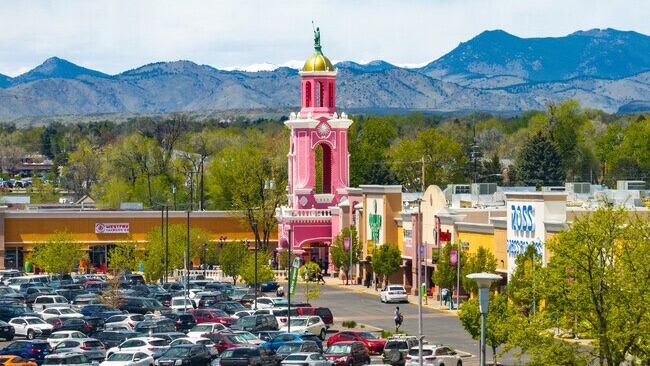
Wheat Ridge's commercial and community destinations are distributed across several corridors rather than concentrated in one traditional downtown. West 38th Avenue has been the subject of long-range corridor planning and includes restaurants, local businesses and services. Wadsworth Boulevard is a major north-south transportation and commercial corridor, while additional businesses and services are distributed along 44th Avenue, Kipling Street and other parts of the city. These corridors can make daily services convenient, but their influence on nearby real estate depends on the individual property. Access, traffic, noise, redevelopment, walkability and the transition between commercial and residential uses can differ from block to block. Buyers should evaluate those conditions directly rather than assuming that all homes near a commercial corridor share the same environment.
Transportation & Regional Access
Wheat Ridge's central west-metro location provides access toward Denver, Golden, Arvada, Lakewood and the foothills. Interstate 70 runs along the northern part of the city, while Wadsworth Boulevard, Kipling Street, 38th Avenue and 44th Avenue serve important local and regional travel patterns. The Wheat Ridge-Ward commuter rail station is located near the city's northwest side and provides another transportation option for that portion of the community. As elsewhere in Wheat Ridge, transportation convenience is highly property-specific. A home near I-70 may offer different regional access and traffic considerations from a property in central Wheat Ridge, while a residence near the Ward station has a different transportation profile from one farther south. Buyers with regular commuting requirements should evaluate realistic routes from the actual property.
Redevelopment & the Lutheran Legacy Campus
Wheat Ridge is an established city, but several areas are undergoing meaningful change. One of the most significant is the former Lutheran hospital campus at 8300 West 38th Avenue. The roughly 100-acre site has been the subject of a dedicated master-planning process following the hospital's move to Clear Creek Crossing. The City adopted a Lutheran Legacy Campus Master Plan to guide redevelopment over a period of 15 to 20 years or more, and subsequent zoning created a dedicated Mixed Use-Lutheran Legacy Campus district. The redevelopment framework contemplates a mix of uses and public space rather than continued use solely as a hospital campus. Because the site is large and centrally located, its evolution is relevant to nearby real estate. Buyers and sellers near the campus should follow current plans and development activity rather than relying on assumptions based on the property's former hospital use.
Housing Growth, Infill & Development
Although Wheat Ridge contains substantial established housing, its housing stock continues to evolve. The City reports that recent development has added detached single-unit homes, small-lot homes, townhouses, duplexes, affordable and workforce housing, and market-rate apartments. Examples include development around the Wheat Ridge-Ward station and other targeted areas. Wheat Ridge also uses residential, commercial, industrial, mixed-use and planned-development zoning districts, so development potential varies by parcel. For buyers considering a property because of lot size, expansion potential or possible accessory uses, zoning and development standards should be verified directly. Sellers should also consider how renovated homes, infill construction and newer attached housing affect the competitive set for their property.
Schools & Education
Wheat Ridge is served by Jeffco Public Schools. The district's Wheat Ridge articulation area includes Wheat Ridge High School, Everitt Middle School and several elementary schools, along with other district options. School information in CohousePro Neighborhood Guides is provided for general location context rather than as a ranking or recommendation. Attendance boundaries, programs, enrollment policies and assignments can change, so buyers should verify current information directly with Jeffco Public Schools for the specific property they are considering.
Local Highlights
Clear Creek
A major natural and recreational corridor crossing Wheat Ridge and connecting into the broader regional trail network.
Established Housing
Much of Wheat Ridge's single-family housing dates from the mid-20th century, creating substantial variation in condition, renovations and property characteristics.
38th Avenue
An important east-west corridor with local businesses, restaurants, services and ongoing community planning.
Wheat Ridge-Ward Station
A commuter rail station near the northwest side of the city that has also become a focus for newer residential development.
Lutheran Legacy Campus
A roughly 100-acre former hospital campus undergoing a long-term transition guided by a dedicated master plan and mixed-use zoning.
West Metro Location
Wheat Ridge sits between Denver, Lakewood, Golden and Arvada, providing access across both the urban core and west metro.
For Buyers
Buying in Wheat Ridge often requires more property-level investigation than the city's relatively compact size might suggest. Consider housing age, renovation history, major systems, additions, lot size and configuration, zoning, accessory structures, drainage, floodplain information where relevant, nearby commercial or redevelopment activity, transportation access and the condition of competing homes. If future expansion, an accessory use or redevelopment potential is important, verify the property's zoning and applicable development standards before relying on those possibilities. Because much of the housing is established, two similarly sized homes can have very different renovation histories and ownership considerations.
For Sellers
Wheat Ridge sellers should identify the property's true competitive set rather than relying primarily on a citywide median. Housing age, renovation quality, lot characteristics, additions, accessory structures, street location and proximity to parks, transportation or commercial corridors can all influence buyer comparisons. Newer infill and renovated homes may also compete differently from properties retaining more original features. Sellers near redevelopment areas such as the Lutheran Legacy Campus or major corridors should understand current nearby activity so marketing can accurately explain the property's location without overstating future outcomes.
Selling resourcesReady to see what's available in Wheat Ridge?
Search Wheat Ridge Homes for SaleWheat Ridge: Common Questions
Where is Wheat Ridge, Colorado?+
Wheat Ridge is in Jefferson County immediately west of Denver. It is bordered or closely connected with Denver, Lakewood, Golden and Arvada and is part of the west Denver metropolitan area.
What types of homes are available in Wheat Ridge?+
Wheat Ridge includes substantial mid-20th-century housing along with renovated older homes, newer detached houses, small-lot homes, townhomes, duplexes and apartments. Housing and lot characteristics vary by neighborhood.
Are many homes in Wheat Ridge older?+
Yes. City housing research has found that the large majority of Wheat Ridge's single-family housing was built between 1940 and 1979. Buyers should evaluate the condition and renovation history of each individual property.
Does Wheat Ridge have a downtown?+
Wheat Ridge does not revolve around one traditional downtown. Commercial and community activity is distributed along corridors including 38th Avenue, Wadsworth Boulevard, 44th Avenue and other parts of the city.
What is happening with the former Lutheran hospital campus?+
The former Lutheran hospital campus on West 38th Avenue is planned for long-term redevelopment under the Lutheran Legacy Campus Master Plan and a dedicated mixed-use zoning district. Buyers and sellers nearby should review current City information as redevelopment progresses.
Does Wheat Ridge have rail transit?+
The Wheat Ridge-Ward station near the northwest side of the city provides commuter rail service. Its usefulness depends on the location of the specific property and the buyer's transportation needs.
What school district serves Wheat Ridge?+
Wheat Ridge is served by Jeffco Public Schools. Buyers should verify current attendance boundaries, enrollment information and school assignments directly with the district for a specific property.
How do I find homes for sale in Wheat Ridge?+
CohousePro's Wheat Ridge real estate page provides a starting point for exploring Wheat Ridge homes for sale. Preston can also help narrow the search by neighborhood, housing type, lot characteristics, condition, price range and other real estate priorities.
Thinking About Buying or Selling in Wheat Ridge?
Wheat Ridge combines established housing, varied lots and neighborhoods, convenient west-metro access, and areas experiencing new development. Let's identify the properties and local competition that matter to your goals and build a strategy around your situation.
Talk With PrestonSources
- City of Wheat Ridge — Residential Housing Developments
- City of Wheat Ridge — Find Your Zoning
- City of Wheat Ridge — Zoning & Development Code
- City of Wheat Ridge — Subarea Plans
- City of Wheat Ridge — Lutheran Legacy Campus Master Plan
- City of Wheat Ridge — Housing Planning
- Jeffco Public Schools — Wheat Ridge Articulation Area